Map for cub hike Sat. With grid-lines, grid-references and scale. With the aid of OpenStreetMap, OpenCycleMap(Outside layer), grid-lines awkwardly and labouriously added - gimp grid sized up and offset applied manually. Grid scales added manually. 1 square is 1km square.
 |
| Larch Hill - Kilmashogue - Three Rock - Tibradden -- Cub Scout Challenge Map with Grid Refs |
OSM's Bigmap is the best way to get a starting image of decent enough size for printing.
And the OpenCycleMap dataset with contours is good for hiking.
Had to use the bigmap perl interface to get image >;-)
Had to sudo apt-get install libgd-dev ^H^H^H^H open ubuntu software manager and install GD perl tools to run it.
http://wiki.openstreetmap.org/wiki/Bigmap
Larch Hill and Kilmashogue:
Try outdoors layer and landscape layers:
GRID REFS: of Kilmashogue wedge tomb, standing stone and grid-ref origin points.
http://irish.gridreferencefinder.com/?gr=O1540024500|O_s_154_s_245|1,O1510024400|O_s_151_s_244|1,O1500024000|O_s_15000_s_24000|1,O1600024000|O_s_16000_s_24000|1,O1400024000|O_s_14000_s_24000|1,O1400025000|O_s_14000_s_25000|1,O1500025000|O_s_15000_s_25000|1,O1600025000|O_s_16000_s_25000|1,O1600023000|O_s_16000_s_23000|1,O1500023000|O_s_15000_s_23000|1,O1400023000|O_s_14000_s_23000|1&v=h
The area of Ireland is divided into 25 squares, measuring 100 by 100 km
ABCDE
FGHJK
LMNO(Dublin)P
QRSTU
VWXYZ EKPUZ are in the Irish Sea.
'Kilmashogue' : Wedge Tomb
Townland Kilmashogue Hill
County Dublin
Grid Ref O 151 244
GPS O 15115 24387 (5m)
Longitude 6° 16' 29.5" W
Latitude 53° 15' 26.49" N
ITM east 480366
ITM north 584435
The chambered cairn at Kilmashogue is known as a wedge tomb.
The cairn has been quite flattened, but you can also see the remnants of the surrounding ditch and bank which would have been a lot deeper when it was first constructed around 2000 B.C.
The ruined portal tomb at Kilmashogue is located at the National campsite of Scouting Ireland.
This tomb has collapsed. It is beautifully situated amongst some trees in the dolmen field next to a babbling brook.
The capstone which has slipped back from the portal stones, is about 3 metres in length.
Only one of the portal stones is still standing, the other lies under one of the roots of a tree.
It is still possible to see some of the cairn material scattered around the chamber.
http://www.megalithomania.com/show/site/23/kilmashogue_standing_stone.htm
'Kilmashogue' : Standing Stone
Townland Kilmashogue Hill
County Dublin
Grid Ref O 154 245
Longitude 6° 16' 13.98" W
Latitude 53° 15' 29.92" N
ITM east 480366
ITM north 584435
These are good, I have used in the past a good bit:
Now we want to make a challenge for Cub scouts.
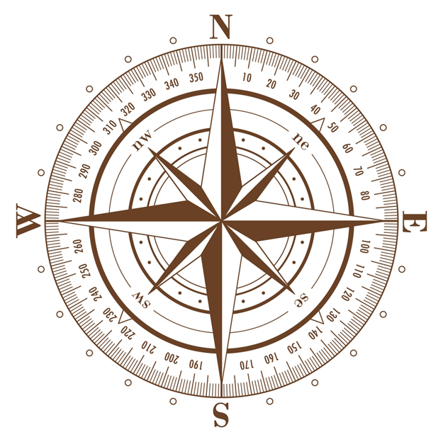
Starting at larch hill, set compasses to bearing. Follow it. Distance and waypoints.
Add waypoints, bearings, distance . . .
Lead stages of hike.
Find interesting points on route.
Verify location using bearings of landmarks.
Cub Scout Map Challenge - Larch Hill - Kilmashogue - Two Rock Fairy Castle
 Start at Larch Hill Scout Centre. Car Park. O 145 239
Find grid ref O 145 239 on map (Larch Hill Scout Centre).
Set Compass to bearing of 70 degrees (ENE).
Follow bearing uphill past playground and through cub field for 300m.
** counting steps is one way of estimating distance **
** how many steps does it take for each person to cross cub field ?
Waypoint 1. Top of Cub field. O 148 240
Set compass to bearing of 20 degrees (NNE).
Climb over fence on to road. (remember leave no trace!)
Follow road NNE for 500m to Kilmashogue Forest car park.
Waypoint 2. Kilmashogue Forest car park. O 150 244
Set compass to bearing of 160 degrees (SSE).
Follow compass bearing to find some steps and a path, travel 50m up path to Kilmashogue Wedge Tomb.
The chambered cairn at Kilmashogue is known as a wedge tomb. There once was a huge cairn of stones built over the tomb but it has now been quite flattened. You can see the remnants of the surrounding ditch and bank which would have been a lot deeper when it was first constructed around 2000 B.C.
Waypoint 3. Kilmashogue Wedge Tomb. O 151 244
Set compass to bearing of 340 degrees (NNW).
Follow the path back to car park.
Set compass to bearing of 80 degrees.
Follow path East for 400m. Can you find the standing stone ?
Waypoint 4. Kilmashogue Standing Stone. O 154 245
Continue East for another 300m
Path turns to South East. Set compass to 135 degrees (SW) follow path for 600m
Waypoint 5. Wicklow Way Zig Zag. O 160 241
Follow the wicklow way, which Zigs to East(270 degrees) for about 100m.
And then Zags back to South East(135 degrees) and turns to SSE(160 degrees) for 900m.
Waypoint 6. Wicklow Way bend and steps. O 164 232
The path to East goes towards Three Rock Mountain.
The path to South-West and then South up stone flag steps follows the Wicklow Way.
Follow the Wicklow Way path to South: SSW 200 degrees for 200m and SSE 160 degrees for 900m.
Waypoint 7. Wicklow Way - Dublin Mountain Way cross-path O 166 222
The path to East goes towards Two Rock - Fairy Castle.
The path to West goes towards Tibradden.
Set compass to 70 degrees (ENE). Follow path uphill 600m to Two Rock mountain Fairy Castle.
Waypoint 8. Two Rock mountain Fairy Castle. O 172 223 go down NNE (30 degrees) for 1.1km to crossroads.
Waypoint 9. Three Rocks O 177 232.
REVIEW - hike done ?/4/2016 - update 13/5/2016
We gave out compasses and maps with the waypoint list to cubs in groups of 2s and 3s.
I don't like annoying them with a map extra thing to carry and get in the way and take from enjoyment of hike.
BUT on occasion I think is good. Really needed for learning maps.
We asked cubs to look at Waypoint, directions and compass bearing.
Then set compass and follow directions and bearing.
We checked and showed everyone how to set compass at the start.
All cubs going in one direction, some cubs probably not sure what they were doing but other cubs doing ok.
At each waypoint we checked directions and bearings. We kind of got different cub groups to lead a section of hike. Cubs asked questions like how far along legs we were and were looking ahead at next directions.
We had good visit to Wedge Tomb and look around. Rob gave a talk. I told what I know. We didn't want to waste too much time so headed on.
We didn't find the standing stone. Must have walked past it.
Note to self, put the GPS co-ords in and mark it in google maps or viewfinder and we will have better chance of finding it. ALSO turn on MapMyHike/ViewRanger plot or whatever at START and set it in hike mode.
Nice enough day. Cloudy with breaks. We were warm hiking. Cubs mostly took off very warm stuff clothes and hats early on. We didn't stop for breaks too much. When we got to zig-zag we went straight along East towards Three Rock. Lunch on Three Rock. There was a beaver group up there climbing on the rocks. Chilly enough wind at lunch time. We put back on coats etc. Shammy left us at Three Rock.
We then headed for Fairy Castle. Then on towards Tibradden. Pretty gratifying one cub anyway was still following route exactly on map had our location (this after we had finished the wayoints). Good stuff. Small breaks only e.g. look at the tomb/folly on Tibradden. Some cubs getting a bit tired but all in pretty good form. Then back down road to Larch Hill Entrance. Then up the road (we should take cubs up paths cross country to avoid traffic in Larch Hill).
 |
| Start of hike up the cub field |
 |
| Quick break on a log nearing Three Rock |
 |
| Lunch time top of Three Rock |
 |
| Path up towards Fairy Castle |
 |
| Where we came from, view of Kilmashogue from near Fairy Castle top |
 |
| View of Three Rock masts and Dublin bay in background from Fairy Castle |


