http://www.youtube.com/watch?v=5TVB7KPXAts
Image data Copyright:
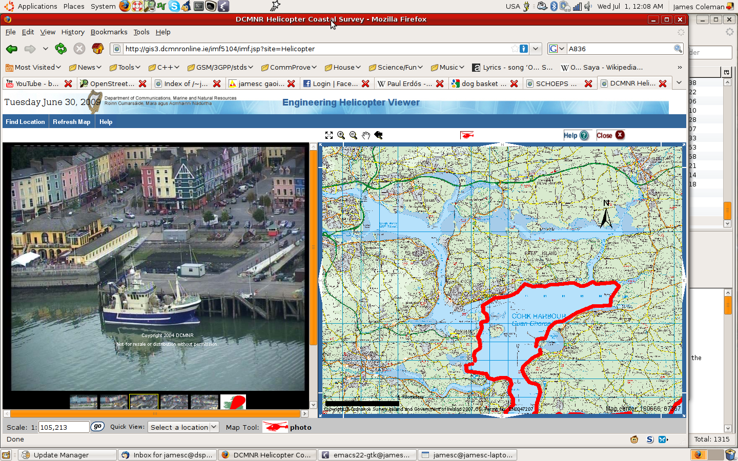
http://gis3.dcmnronline.ie/imf5104/imf.jsp?site=Helicopter
It would be nice if GIS info were available to taxpayers! poke. poke.
And if GIS browsing site had more features.
Basic bookmarking/linking would be nice.
Anyone want to write a cloudy app?
It's not fantastically wonderful data really .. maybe,
BASEURL=http://gis3.dcmnronline.ie/sorted/
for (( i=87198 ; i<=88123 ; i++ )) ; do
 echo i=$i;
 wget -c $BASEURL/$i.jpg ;
done

for (( i=87198,j=0 ; i<=88123 ; i++,j++ )) ; do
 ln -s $i.jpg $j.jpg;
done

# -r is framerate in fps, -b bitrate
FFFLAGS=-title 'Helicopter Coast Cork Harbour http://gis3.dcmnronline.ie/imf5104/imf.jsp?site=Helicopter'
ffmpeg $FFFLAGS -r 3 -b 1800 -i helisound.mp3 -i %d.jpg HelicopterCoastCorkHarbour.mp4

# ugh, yes. sorry about the audio
# 995 images, 8M video.
http://gis3.dcmnronline.ie/output/ENG_HELICOPTER_dcmnrgis-web134762684331.png
http://gis3.dcmnronline.ie/sorted/87685.jpg
Cuskinney, Cobh
http://gis3.dcmnronline.ie/sorted/87654.jpg
The slip in Cobh
http://gis3.dcmnronline.ie/sorted/100741.jpg
Dublin joyce martello tower sandycove
http://gis3.dcmnronline.ie/sorted/104513.jpg
Dundalk
http://gis3.dcmnronline.ie/sorted/1.jpg
Throat of malin
87k * 100000 images = 8700000k = 8.7G
Hmmmmm >;)
http://gis3.dcmnronline.ie/sorted/88123.jpg
out to R of Roches Point (and of Cork harbour)
http://gis3.dcmnronline.ie/sorted/87198.jpg
well out of (Cork) harbour to left
http://en.wikipedia.org/wiki/HNLMS_Amsterdam_(A836)
http://www.defensie.nl/marine/operationeel/schepen/hr_ms_amsterdam/
http://gis3.dcmnronline.ie/sorted/87638.jpg
http://gis3.dcmnronline.ie/sorted/87639.jpg
http://gis3.dcmnronline.ie/sorted/87640.jpg
http://gis3.dcmnronline.ie/sorted/87641.jpg
http://gis3.dcmnronline.ie/sorted/87642.jpg
87638 bow -> 42 stern
http://gis3.dcmnronline.ie/imf5104/imf.jsp?site=Helicopter
2 comments:
"It would be nice if GIS info were available to taxpayers! poke. poke."
Ummm... who are you poking?
I'm poking OSI.
Set the data free!
Or at least allow basic datasets available at reasonable cost.
And the Queen of England - Set the tidal data free!
http://www.wxtide32.com/faq.html#faq02
Set it free so people can do stuff with it.
Like sharing/publishing science vs keeping it secret.
Maps for Ireland for SatNav I think are not from OSI because they're too expensive.
The Americans successfully made the argument that the organisations collecting map data were all tax funded so the data belongs to the public.
And it's a reasonable position economically anyway.
You're not going to make tons of money off of basic data anyway especially if you price it off the market.
For basic map data openstreetmap is going to takeover the world anyway Muaghahahahaaaaa :) http://www.openstreetmap.org
Jumping completely off topic almost, these guys have nice new maps (just pdf format): http://www.dublinmountains.ie/home/
Post a Comment